The best circular walk in the North York Moors
Showing posts with label Inn Way Journal". Show all posts

Day 4


Egton Bridge to Rosedale Abbey


15 miles


We had a good breakfast in the sunny conservatory of the Old Mill and set off in high spirits on a lovely morning.  The first job was to cross the stepping stones but we were used to them now.


Leaving Egton Bridge

Back across the stones

We soon left the road at an Inn Way sign for Delves and as usual, spent some time crossing fields and stiles until we re-joined the road at the village of Delves. We walked through the village and then took a track into Arncliffe Wood.


Follow the sign to Delves

Descending to Delves

Entering Arncliffe Wood

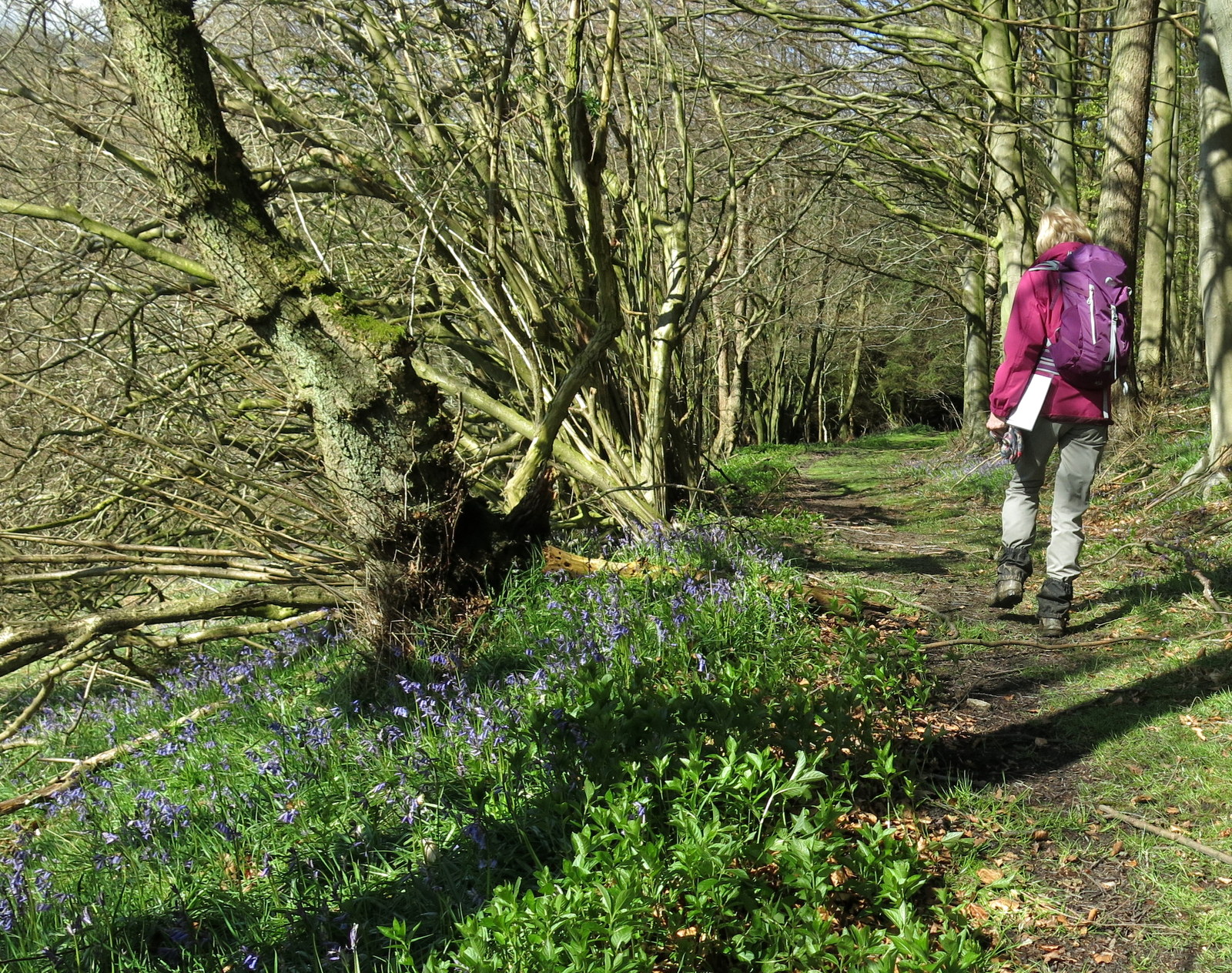
 Some sections in Arncliffe Wood were paved 'trods,' an old pannier-man's way which made the going easy and we were pleased that the tracks weren't the muddy mess we had got used to yesterday.  We came to a large stone known as the Wishing Stone.  Our Inn Way book explained that it was believed that if you circumnavigated the stone three times your wish would come true.  I walked on leaving Carole circling the stone...


Carole considers the Wishing Stone

Catching up after circumnavigation

The Pannier-man's trod through Arncliffe Woods

The trod descended to reach the River Esk where it resumed as a track beside the river.  We followed the river for a while and reached a pub called the Arncliffe Arms. We then climbed the steep road to reach the village of Glaisdale. 


The River Esk

Looking back down river

Climbing into Glaisdale

Leaving the village we descended to the river once more and soon reached a very pretty old mill.


The old mill near Glaisdale


We continued by the river and crossing fields to reach the village of Lealholm where we were delighted to see a small cafe.  The lady running the cafe was a farmer's wife and as we enjoyed our cream scones and coffee she told us how badly the lambs were doing in this unusually cold weather. She explained that when a sheep gives birth to twins outdoors the first-born often dies of cold while she is giving birth to the second.


Weather vane near Glaisdale

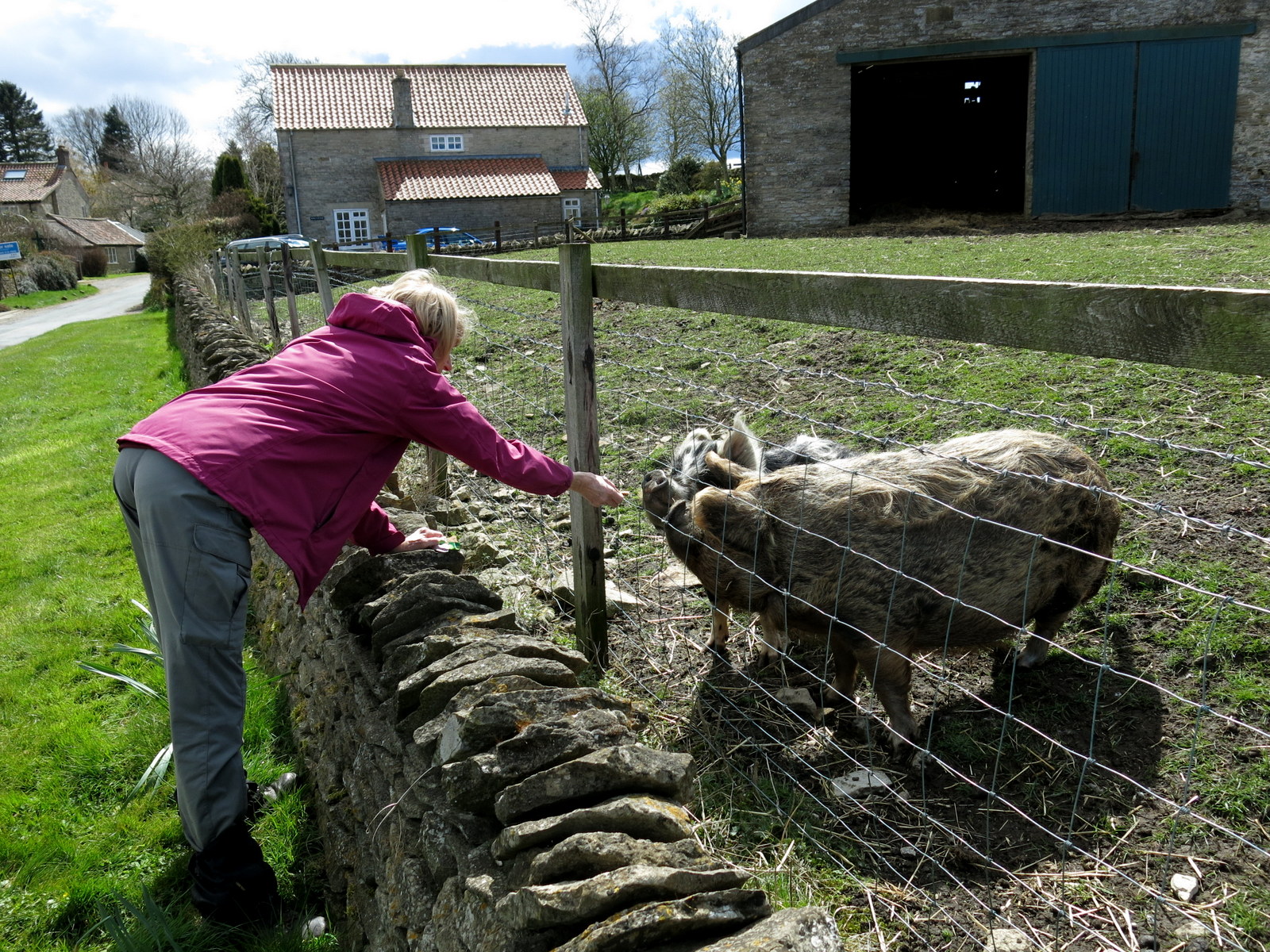
Carole makes a friend


A grassy path besides the river

Hurrying out of our way

Lealholm and what does that sign say....?

"Share my scone...?"

"You cannot be serious!"


Leaving Lealholm we now walked for a couple of miles on the road until we reached a sign marked 'Glaisdale Rigg', onto the moors and on to some narrow paths which would be difficult to navigate in bad weather.  Some sections were boggy and the moor seems vast and bleak until a clearer path is gained along Glaisdale Rigg.  A rigg implies a ridge and our path followed this long curving feature for some distance across the top of the moor.


Climbing to Glaisdale Rigg

The Inn Way book mentions these standing stones so we must be right!


Walking along Glaisdale Rigg

Eventually there were fine views into Great Fryup Dale on our right and our notes said to look out for a large cairn at the head of the valley, which we located easily.  We then had to look for a smaller cairn, which we missed because it was a poor effort and set back from the track.  We wasted some time to-ing and fro-ing trying to find our turn off before back tracking to spot the elusive cairn.


Carole looks into Great Fryup Dale

Leaving the rigg path and entering the rough moor again was a boggy experience and we were grateful when we came to the 'George Gap Causeway'.  This is another stone trod which seems to appear and disappear; one suspects some sections have simply sunk beneath the moor. We were pleased to walk on the causeway when we could, both for the firm surface and as a directional aid.

The George Gap Causeway


The white square ahead of Carole is a marker on the Lyke Wake Walk

At one point we crossed a very worn, wide path which is the famous Lyke Wake Walk and as the rain had started, we stopped to change into waterproofs.  Hail stung our faces and rain tried to get under our hoods.  It made us admire the builders of the trod and the hardiness of our ancestors who didn't have the luxury of Gortex.


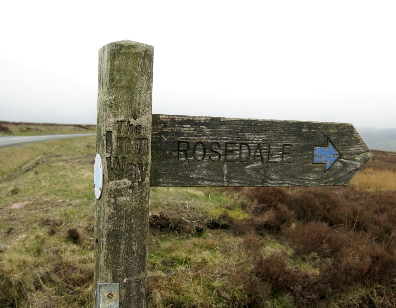
An older sign to 'ROSDAL'

Last photo of the day

By now the rain was torrential and I put my camera away in a waterproof bag.  Our long walk to Rosedale was along a path that necessitated much gate opening and closing with our sodden gloves.  Our wet weather gear was working well and we were still dry inside our man-made shells.  We discussed what a different experience this would be on a nice day and how grateful we were not to be sheep.

Fortunately there were no more steep climbs and we passed on to Rosedale Abbey slightly chilled but in good spirits.  We squelched into The White Horse Inn and the landlady kindly called the August Guest House, which is a mile outside Rosedale.  We then booked a meal at the inn for later in the evening and were soon being taken to our accommodation by our considerate and entertaining host for the night.

We were relieved of our wet gear with a promise that it would all be dried next to the Aga and went to our room for a cup of tea and a hot shower.  Another good day!


To Day 5


Day 6


Hawnby to Helmsley


16 miles


At last, a dry and bright day was in prospect with nothing more than a shower expected.  An excellent breakfast was provided at the Inn at Hawnby and we set off in high spirits.

We retraced our steps from the previous day, repeating the long steep ascent past Arden Hall to Dale Town Common, but it seemed a different world to yesterday's walk in snow.

We crossed Dale House Common, this time turning right away from High Buildings and followed narrow boggy paths through the heather.  Some of the going was awkward but we made good progress and reached and crossed the old drovers' road of Hambleton Street.

We left the moor and soon reached High Paradise Farm, where there is a very nice tea room, and we stopped to enjoy coffee and fruit scones and cream.


Leaving Hawnby

Inn Way sign at Church Bridge, Hawnby

Everyone looks happier in the morning sunshine

Climbing through the woods at Coomb Hill

The rooftops of Arden Hall and Guinea fowl

Arden Hall from the road

Climbing to Dale Town Common, Hawnby Hill and Easterside Hill in the distance

On Dale Town Common

Crossing Hambleton Street

Delicious scones at High Paradise Farm

High Paradise Farm

We now joined the Cleveland Way path for a while and climbed gently through woodland until we reached the road at Sneck Yate.  After that we walked along the edge of the escarpment for a couple of miles with fabulous views, agreeing that this was one of the nicest stretches of the whole walk.


Walking along the escarpment

Ancient High Barn

Quarries and the remains of a hill fort

We passed by High Barn and continued along the ridge to an old quarry and then Boltby Scar cliffs, beyond which we could see the remains of a hill fort below us.

Another 1.25 miles brought us to a bench at a turn off signposted Dialstone Farm.  We sat on the bench admiring the view below of Gormire Lake and Whitestone Cliff.


Whitestone Cliff and Gormire Lake below

Sign on our bench

What a view!

We turned away from the edge towards Dialstone Farm, which had once been a drovers' inn, and put our hoods up for a brief shower of stinging hail.


Dialstone Farm, once a drovers' inn

We dropped through a couple of fields to reach the village of Cold Kirby where we followed the Inn Way sign to Scawton.  By this time we were ready for another break and sat on a bench near the green at Scawton.  As we enjoyed our flask of coffee we heard a loud snuffling from behind and saw we were being watched by two pigs.  Carole couldn't resist feeding them biscuits.


Flassen Dale, between Cold Kirby and Scawton


Yummy, biscuits!


The church at Scawton


Weather vane on house opposite the church - its tree on the wrong side but otherwise super!

Leaving Scawton by the road we looked out for the sharp bend and chevron after 0.5 mile, where our path headed to Stocking House Farm before turning right (before reaching the farm) to Spring Wood.  We dropped down to see the large man made lakes of Nettle Dale.


Spring Wood

Nettle Dale

Duck sign at Nettle Dale


We pressed on following yellow way-marks through the fields and reached Bow Bridge which had an old iron YNR (Yorkshire North Riding) sign,


Crossing Bow Bridge

Leave the road near Bow Bridge

Just after Bow Bridge we saw another Inn Way signpost, pointing us away from the road to Rievaulx.  We followed field paths and Rievaulx Abbey, in its beautiful setting, appeared in the distance.


Rievaulx appears in the distance

Rievaulx Abbey
We walked along the road in front of the abbey admiring it from every angle and after half a mile came to Rievaulx Bridge, where we turned left, signed Helmsley.


Rievaulx Bridge

We walked along the road giving us a different view of the abbey and after a short distance saw a track to our right, signposted 'Cleveland Way, Helmsley 2.25 miles', which we took.

The Abbey from near Rievaulx Bridge

We leave the road to climb to Quarry Bank Wood


We are escorted at Quarry Bank


Climbing Whinney Bank

The walk was now very straightforward along the top of Whinney Bank, with fields to the left and trees to the right.  Soon, Helmsley Castle appeared in the distance.  In no time we were walking into the pretty market town of Helmsley and to our accommodation for the night, The Feathers Hotel.


The last mile

Helmsley appears through the trees

Helmsley

Helmsley Castle

Helmsley Square

The view from our hotel room

After a hot shower and change of clothes we celebrated in style, enjoying real ale in the bijou bar of Helmsley Brewery before returning to The Feathers for an excellent dinner.  A fine end to a fine walk.

We had enjoyed walking the Inn Way to the North York Moors.  On reflection it may have been better walking later in the season but both the week before and the week after we did it were fine and dry.  

Whatever the weather we had a great time and we would certainly recommend this walk.  We used 'Brigantes' to book our accommodation and move our luggage and the service they provided was excellent.  We followed the directions in Mark Reid's book 'The Inn Way to the North York Moors'.

Drop me a line  (huwfoster@yahoo.co.uk)  if you want my GPS track, I'll be happy to send it.


Back to start